
Landcare Led Bushfire Recovery
Every layer of this thriving bushland reveals treasures.
Surveys
In 2020 LTCA brought in local ecologists Wildlife Unlimited to revisit the 2002 biodiversity survey across the Red Bluff area. The study compared data on numbers and movements of a range of animals, and flora and vegetation mapping measured the health of the environment they depend on.
Vegetation Survey Final Report - Oneonta, Lake Tyers Beach (2022)
Flora Surveys and Vegetation Mapping of the Red Bluff Area, Final Report (2022)
Cliff Top Walk
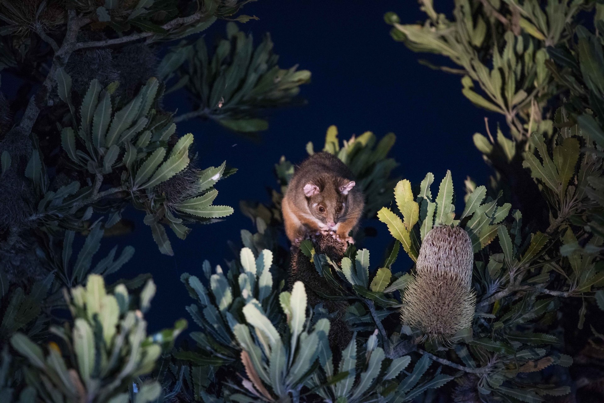
Along the Cliff Top Walk between Red Bluff and Mullett Street interpretive signage installed 20 years ago was updated to highlight the ‘up close and wild’ experience of this walk right on our doorstep, and the rich biodiversity still thriving among its healthy coastal woodlands and heathlands.
Take a stroll on mostly flat tracks from Red Bluff, Salmon Road or Mullett Street entry points -glimpses of the ocean and the pulse of the tides beckon from below, and Owls and Lyrebirds hunt and roam in hidden gullies. Staying on the quiet and narrow pathways through clifftop woodland gets you up close to all the ingredients that make homes for rare plants and animals


